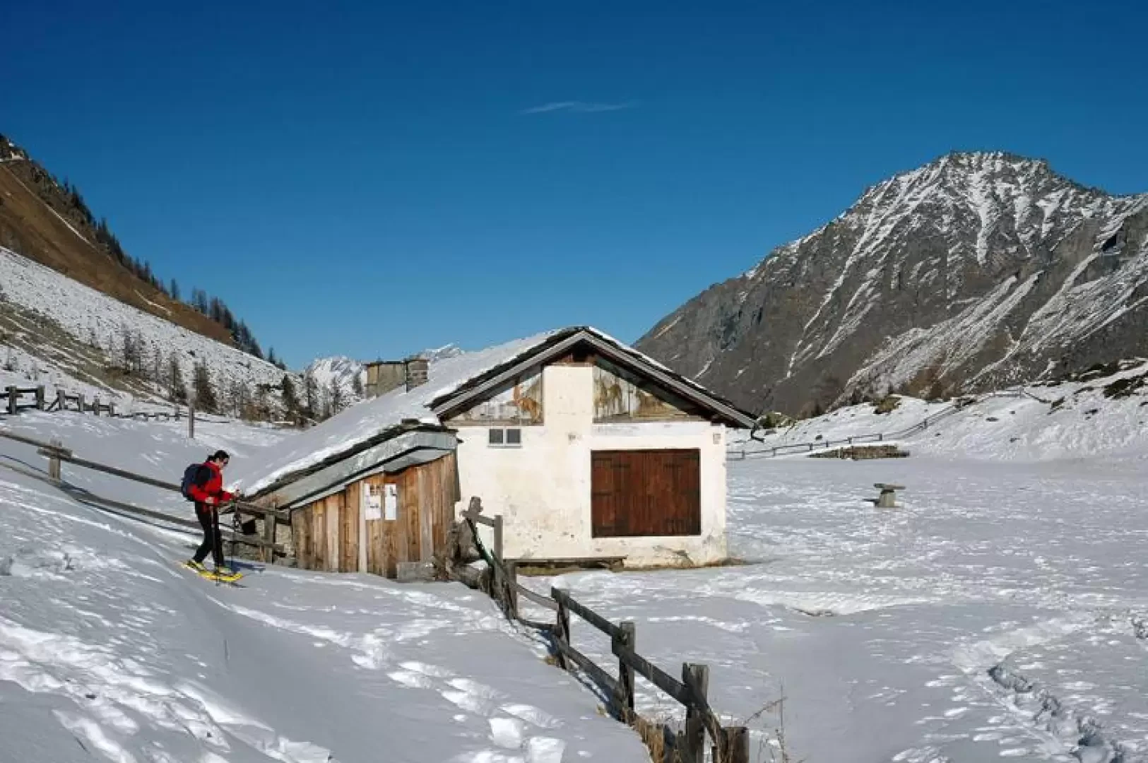
Orvieille PNP Lodge, from Dégioz

Access
From the motorway barrier at Aosta-West, keep left and follow the signs for Aosta - Saint-Pierre. After one kilometre, at the roundabout, take the second exit to join the national road . Continue on the state road for 4.3 kilometres, passing the village of Saint-Pierre until you reach a new roundabout with the Gran Paradiso National Park sign. Take the first exit and continue on the state road for 1.4 kilometres until you come to the exit for Introd/Rhemes S.G/Rhemes N.D/Valsavarenche. Continue for 700 metres and at the roundabout take the first exit onto for Valsavarenche. Follow the regional road for 3.9 kilometres, pass the village of Introd and, after a series of hairpin bends, you will reach the junction for Val di Rhêmes . Continue left onto and climb the valley for a further 16.1 kilometres until you reach the main town of Dégioz where, on the right, you will find the Gran Paradiso National Park visitors' centre and a convenient free car park 🅿️.
[0h35'] - [23.5m]
How to get there with GMaps
How to get there with Apple Maps
Pont Valsavarenche can also be reached by bus with the company Get there, leaving from Villeneuve in about 35 minutes.
The indications given here have been verified on the date of the survey of the itinerary. Before setting off, it is advisable to make sure that no substantial changes have occurred on the route to the starting point. We therefore recommend using the satellite navigation apps provided by Google or Apple for up-to-date and detailed directions.
Introduction
Between history and nature: an itinerary in the important setting of the Gran Paradiso National Park, on the tracks of chamois and ibex along the Royal mule track built by Victor Emmanuel II.
Description
Leaving the car park, follow the signposts and climb up the path that leads to the village of Vers le Bois (1545m). At first you walk alongside a palisade, then pass a fountain and, just before reaching a small chapel, you meet the signposts indicating that you should continue to the right. Take the wide Reale mule-track and you will immediately come across the signs indicating the entrance to the Gran Paradiso National Park.
The path starts out flat and, after about 5 minutes, turns sharply to the left, beginning to climb the slope below the Fourquin de Bioula.
The path continues with a gentle climb through a forest of larch and spruce.
After about 25 minutes, the forest opens up at the height of a large landslide that fell from the peaks above in ancient times; this "cleft" allows us to catch a glimpse of the Fourquin de la Bioula and, at the bottom of the valley, Mont Fallère, the Côte Tardiva and the Pointe de Chaligne.
We continue along the wide, comfortable mule track that heads south without any major differences in altitude: it is not difficult to come across chamois and especially ibex along the way. You leave the forest to cross a dangerous traverse: where the avalanche flows are evident.
After the traverse, you finally reach the plateau in front of the Casa Reale di Caccia now used as the Casotto dei Guardia Parco (2165 m, 2h00'): the latter is reached in a few minutes. Near the Casotto, the Tour du Mont Blanc trail starts, leading to the Bioula peak (3414m).
In front of us, an exceptional panorama opens up over the Valsavarenche mountains (Mont Favret, Grand Nomenon and Grivola) and in the distance, towards the valley floor, the Grand Combin group. For the descent, you can either retrace the itinerary of the outward journey or close the route with a circular loop.
Near the Casotto, you will find the above-mentioned crossroads and continue in the direction of Creton following the path (7). You skirt the Casotto fence for a stretch and then begin the descent on a path that is less wide than the uphill one, which rapidly loses height with a series of hairpin bends.
After the first part of the descent, you come to a fork: turn right and continue the descent through the forest until you come to the cottages of Carré (2042 m, 2h15'), from where you can admire the sharp lines of the Herbetetet and Gran Paradiso. Continue the descent on the path through the fir forest, crossing a couple of streams on small wooden bridges.
Next, cross pastures and reach the village of Creton (1595 m, 3h00') in a few minutes. Turn left onto the track and, after crossing a downhill ski slope, continue slightly downhill to the starting point. The route is mainly south-facing and crosses several avalanche couloirs: caution is advised and, above all, consult the snow and weather bulletins before setting off! The Royal Hunting Lodge at Orvieille was built in 1862 at the behest of King Victor Emmanuel II as a base point for his hunting trips. In 1982, an avalanche hit the structure and led to its reconstruction, which is currently used by the Park Guards as a hunting lodge.
Riferimenti Bibliografici
- Tracce Lievi - Martini Massimo - Martini Multimedia Editore, 2007