Nana Pass, from Malgaroi

Edited by:
Maurizio Loconti
Updated at: 04/05/2025
Access
Arriving in Cles (658 m) from the north, you do not enter the town centre, but turn right and initially follow the signs for a rest home. Afterwards, you turn up towards the Bersaglio restaurant (no signs!). Afterwards, the road climbs the mountain and, until almost the Verdè locality, is asphalted, then it becomes a dirt road (check the condition) usually in good condition. It must be said that it helps and a lot, in the uphill stretches, is cemented. After 18 km, leave your car in the small car park at the Dorigat pond (1869 m - you must arrive early!) or shortly before at the junction with Malgaroi.
.Introduction
The Peller area is beautiful and deserves at least a visit!
Description
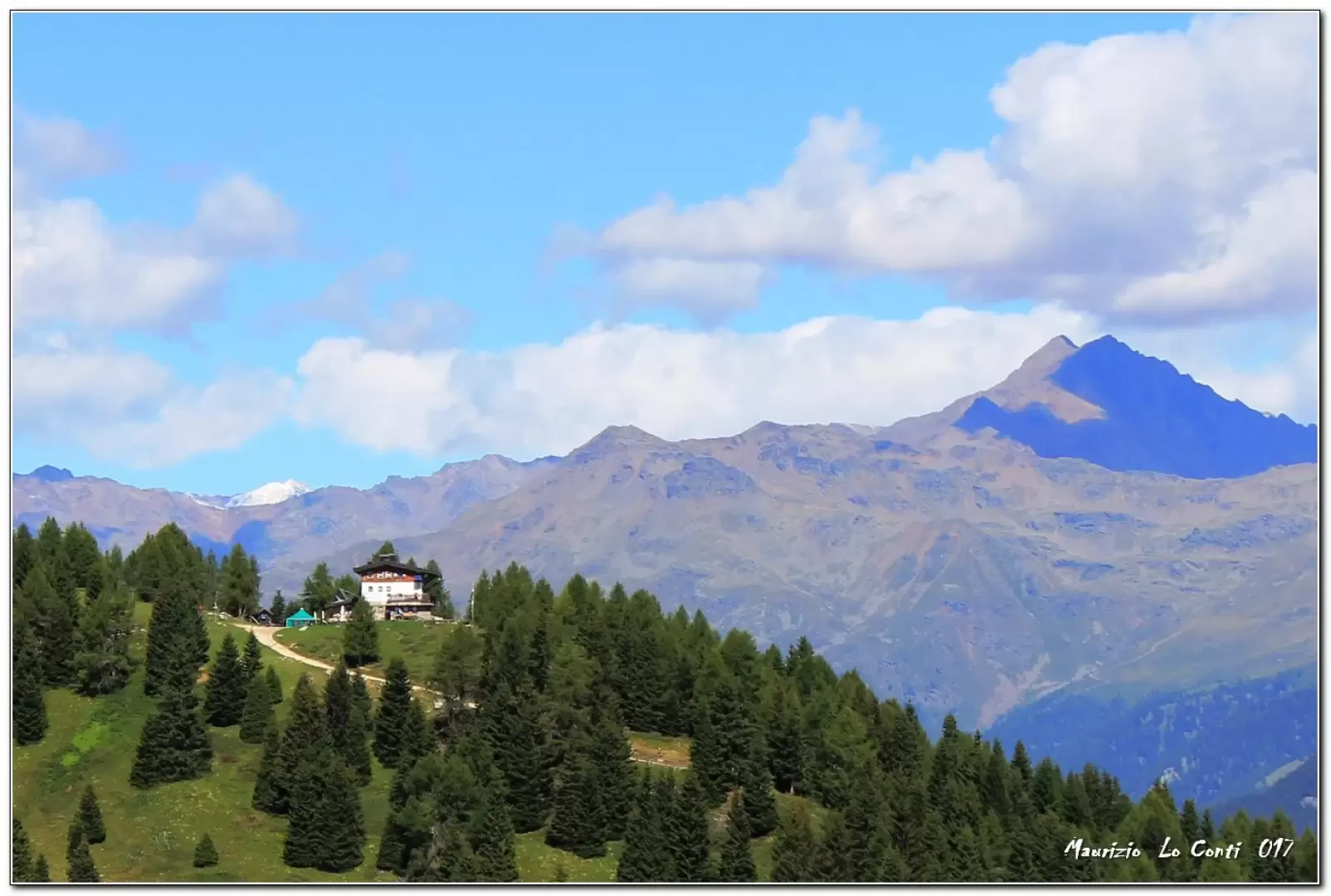
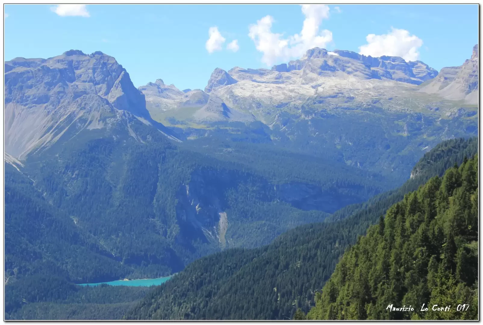
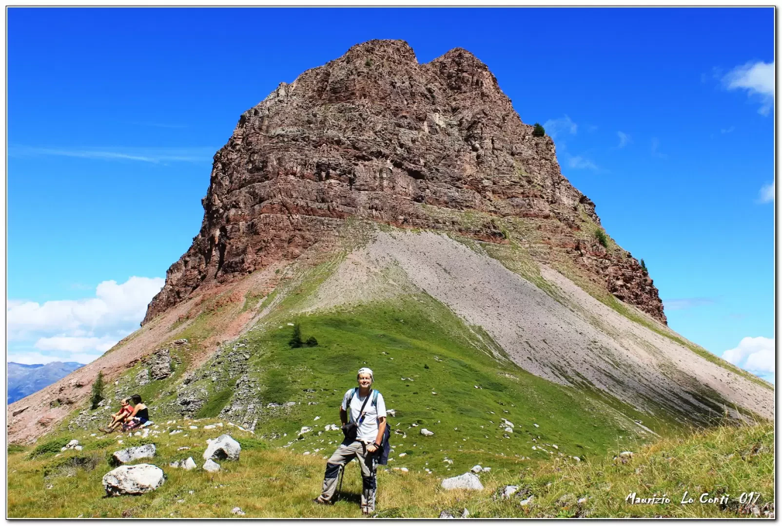
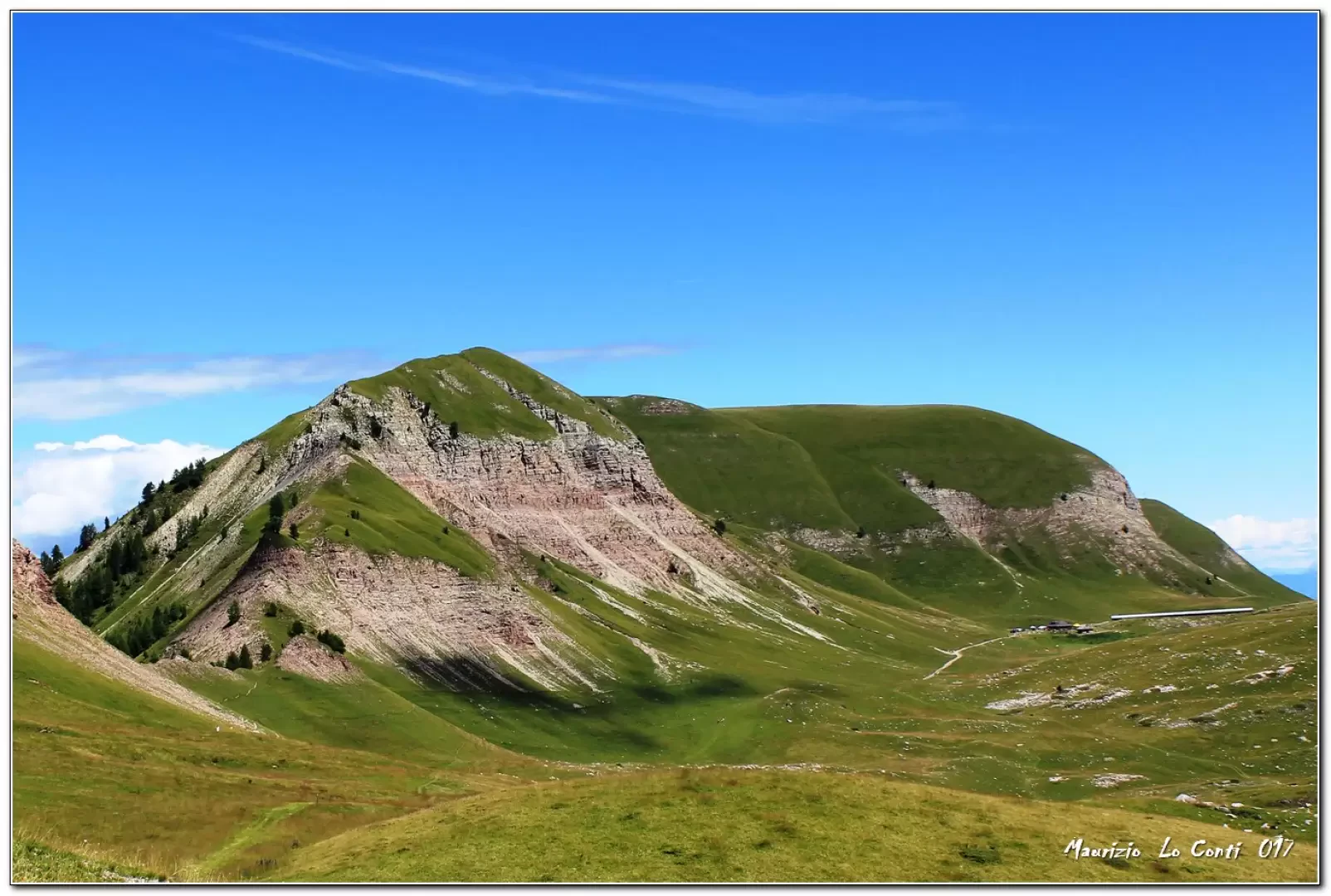
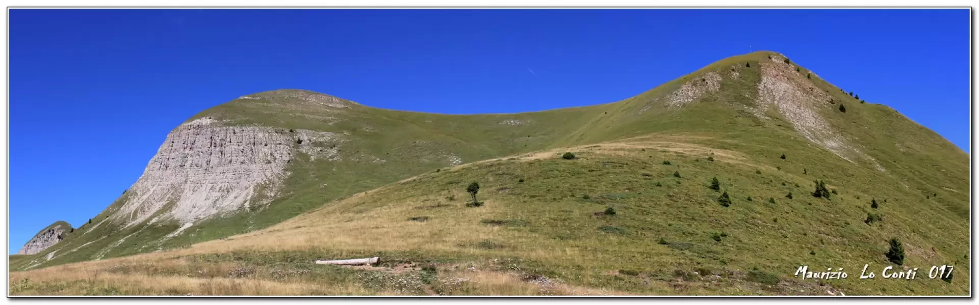
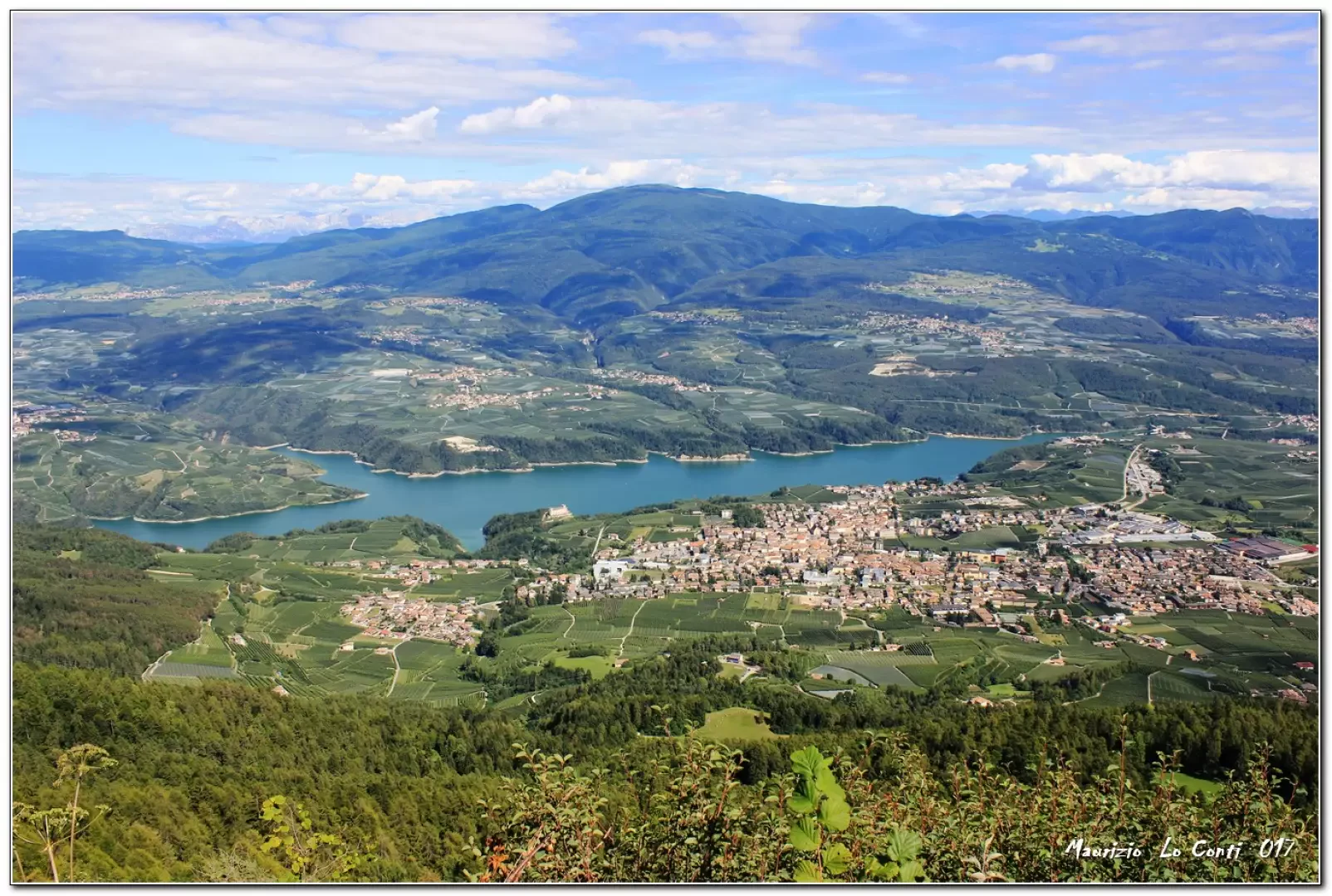
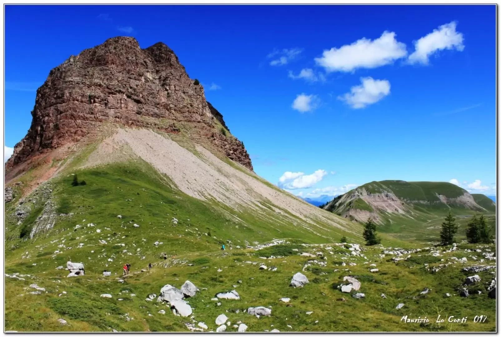
At the height of Malgaroi (1800 m), this time you leave the car and in 10' walk you have reached the fork x Peller. From there, we chose to turn left uphill to MalgaTassulla. In the distance: Rif. Peller 1990 m and Malga Culmei 1760 m. It soon flattens out, offering unparalleled views. Lake Tovel stands out in front! While to the right is the entire Peller ridge, with its summit cross. A comfortable road leads from Malga Tassulla 2090 m. We then continue on to the Nana pass (2195 m), which offers further breathtaking views, in a stupendous area and on a Super weather day: the Peller group (2320 m the highest point). the magnificent Palon (2320 m), towards the Vioz and Cevedale... The overall view is dreamlike! We return to Malga Tassulla for a lunch break and then return along the morning route to where the car awaits.
In summary: Beautiful day disl 400 mt Dif. T for about 3h15 Tot. (average speed slightly above the usual standard) + all the long breaks to see the various places you come across.
If you want, here is the pdf photo file, with a bit more:
http://cralgalliera.altervista.org/FolgEst17/Trentino017F.pdf
http://cralgalliera.altervista.org/FolgEst17/1707Fg4Palon.jpg
http://cralgalliera.altervista.org/FolgEst17/1707Fg5Peller.jpg
http://cralgalliera.altervista.org/FolgEst17/1707Fg6Peller.jpg
http://cralgalliera.altervista.org/FolgEst17/1707Fg7BorgoClesLagoSGiustina.jpg
NB: In the case of an excursion, always check with FIE, Cai, any park authority or other institutions, pro loco, etc., that there have been no changes that have increased the difficulties! No liability is accepted. The present text is purely indicative and not exhaustive.
Info Hiking Section Cral Galliera: http://www.cralgalliera.altervista.org/esc.htm
Trips 2022 at the link: http://www.cralgalliera.altervista.org/gite022.pdf
Galleria fotografica