Mont Molar, from the La Barma car park

Edited by:
Massimo Martini
Updated at: 11/07/2026
Access
From the Châtillon motorway exit, turn left onto Via E. Chanoux. Go past the roundabout, take the third exit and continue through the town centre for about 600 metres, then turn right into Via Menabrea. Follow this road to the roundabout with the 'Matterhorn' in the middle. Continue along the regional road for 18.7 kilometres to Valtournenche, where, towards the end of the town centre, at Hotel des Neiges, turn right and up the municipal road to Cheneil. Follow the road for 6.5 kilometres to the 🅿️ car park at La Barma, the starting point of the hike. The car park is large, but due to the large number of people, it is advisable to arrive early enough on peak days to avoid having to leave your car further down the ascent road. Just beyond the starting point there is a tourist lift, always in operation, which saves 50 metres of ascent.
[0h42'] - [26.9km]
How to get there with GMaps
How to get there with Apple Maps
The directions provided have been carefully checked as of the date the route was taken. However, it is highly recommended to check for any changes that may have occurred since then, especially regarding the route to the starting point. Before embarking on your journey, it is advisable to consult up-to-date navigation tools for accurate and up-to-date directions. We recommend the use of satellite navigation apps, such as Google Maps or Apple Maps, to ensure the most accurate and safe routing.
Introduction
Itinerario di andata e ritorno dal parcheggio di La Barma (2.035m), nel comune di Valtournenche, verso la vetta occidentale del Mont de Molar (2.485m). Il percorso risale il versante meridionale della montagna attraversando il bosco rado di larici, gli alpeggi di Château (2.131m) e Goilles (2.215m) e un valloncello erboso, fino a raggiungere la cresta meridionale e, per breve tratto di pendio ripido, la cima.
Dal Château in poi il tracciato è privo di segnaletica e si affida a tracce di bestiame tra i pascoli, con un carattere esplorativo rispetto agli itinerari segnalati della conca di Cheneil. L’itinerario è tra i meno frequentati del versante. Lungo la via si attraversa un ru in disuso, testimonianza del sistema di irrigazione tradizionale un tempo attivo a queste quote. Dalla vetta, di morfologia erbosa con scarpate rocciose sul versante nord, il panorama si apre sulla Valtournenche e sulla Conca di Cheneil; in visuale ravvicinata emergono la parete della Becca d’Aran e la cresta delle Grandes Murailles.
La gita è consigliata tra luglio e settembre, a terreno sgombro da neve. La difficoltà tecnica è contenuta, ma l’assenza di segnaletica nel tratto superiore richiede capacità di orientamento e buona visibilità: in caso di nebbia l’itinerario non è consigliato.
Description
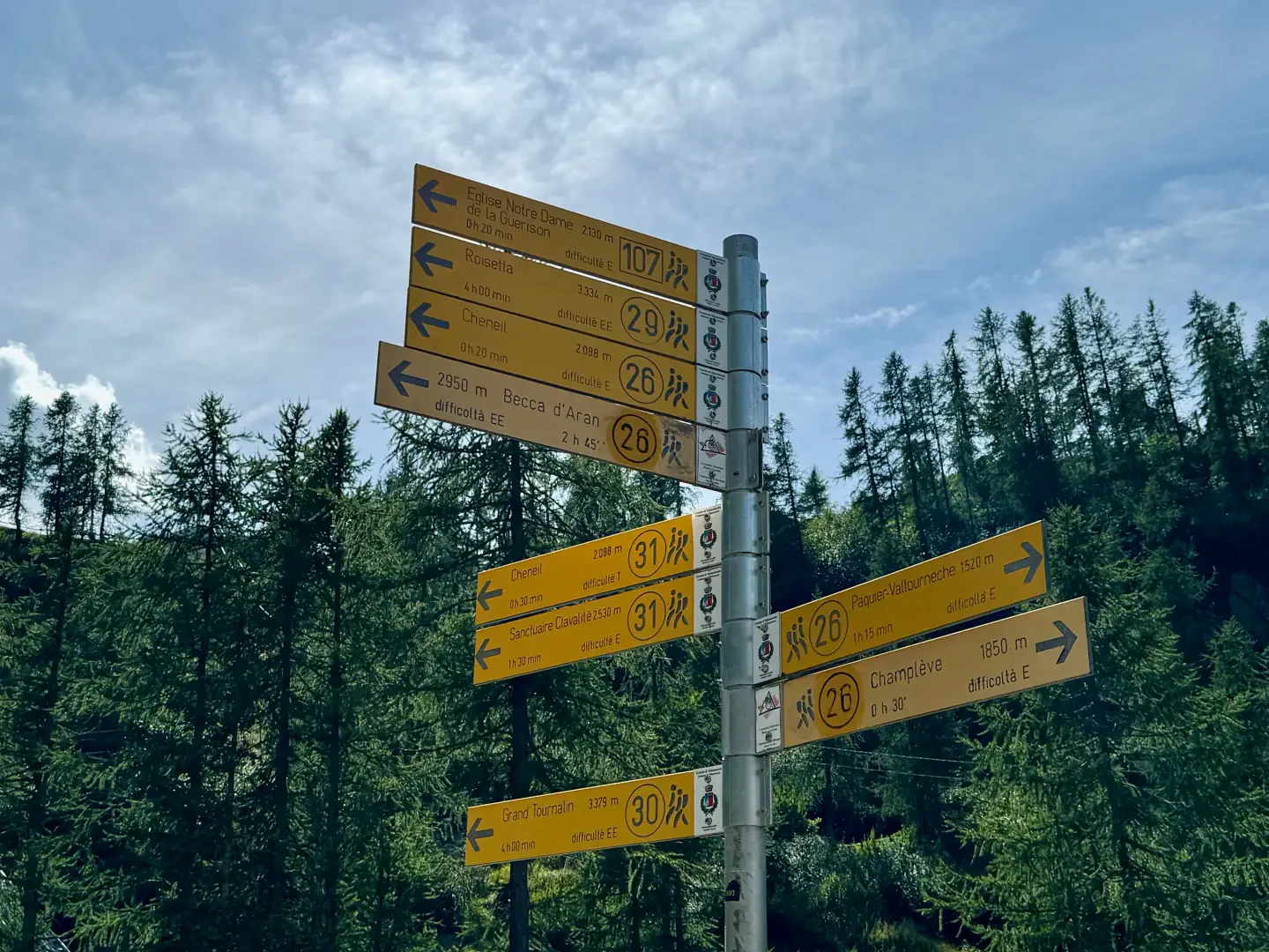
0h00' 0.00km From the end of the car park, spot a signpost indicating the main paths in the area. Turn left, following the signs for paths and , up a steep farm track which, after a hairpin bend to the right, quickly enters the sparse larch forest (Larix decidua). In a few minutes you reach the summit of the climb, where you briefly join the route of the Great Matterhorn Balcony .
0h12' 0.33km After passing a small panoramic saddle, a splendid view opens up over the village of Cheneil, nestling in the green pastures. From here, descend briefly along the path until you come to another marker post.
0h15' 0.41km Ignore the signs for the village of Cheneil and continue along the farm road, which climbs slightly. In a few minutes, you reach the Château pastures (2131m).
Punti di Interesse
• Château
• Alpeggio di Goilles
• Vetta occidentale del Mont de Molar
Collections
• escursioni a Valtournenche | lista - mappa
• escursioni alle vette in Valtournenche | lista - mappa
• escursioni con partenza dal parcheggio di La Barma | lista - mappa
• escursioni in Valle d’Aosta | lista - mappa
• escursioni in Valtournenche | lista - mappa
• escursioni sui 2000 in Valle d’Aosta | lista - mappa
Photo gallery

Comments (0)
Sign in to leave a comment