Merendioux, from the Fénillettaz car park

Edited by:
Massimo Martini
Updated at: 21/11/2026
Access
Road directions
Leave the [A5] motorway at the Verrès exit. At the roundabout, take the second exit and continue for 300m (0.3km), then turn left onto the towards Val d’Ayas. Follow the for 15.6 km (15.9 km), travelling up the valley through Challand-Saint-Victor and Challand-Saint-Anselme to Brusson. Drive through the village and, just before the junction for the Col de Joux, turn right, following the signs for Estoul. Follow the local road uphill for 6.5 km (22.4 km) and, on the final stretch, turn left towards the Fénillettaz car park.
Car park
At the top of the climb is the free 🅿️ Fénillettaz car park, the starting point of the route.
Access by public transport
You will need a private vehicle to reach the route’s starting point, as the village is not served by public transport.
Distance and journey time
🕒 Journey time: 36 minutes
📏 Distance: 22.4 km
GPS navigation
Important information
The directions provided were verified on the date the route was mapped. Before setting off, we recommend checking for any changes to the route or road conditions. For up-to-date information, please consult Google Maps or Apple Maps.
Introduction
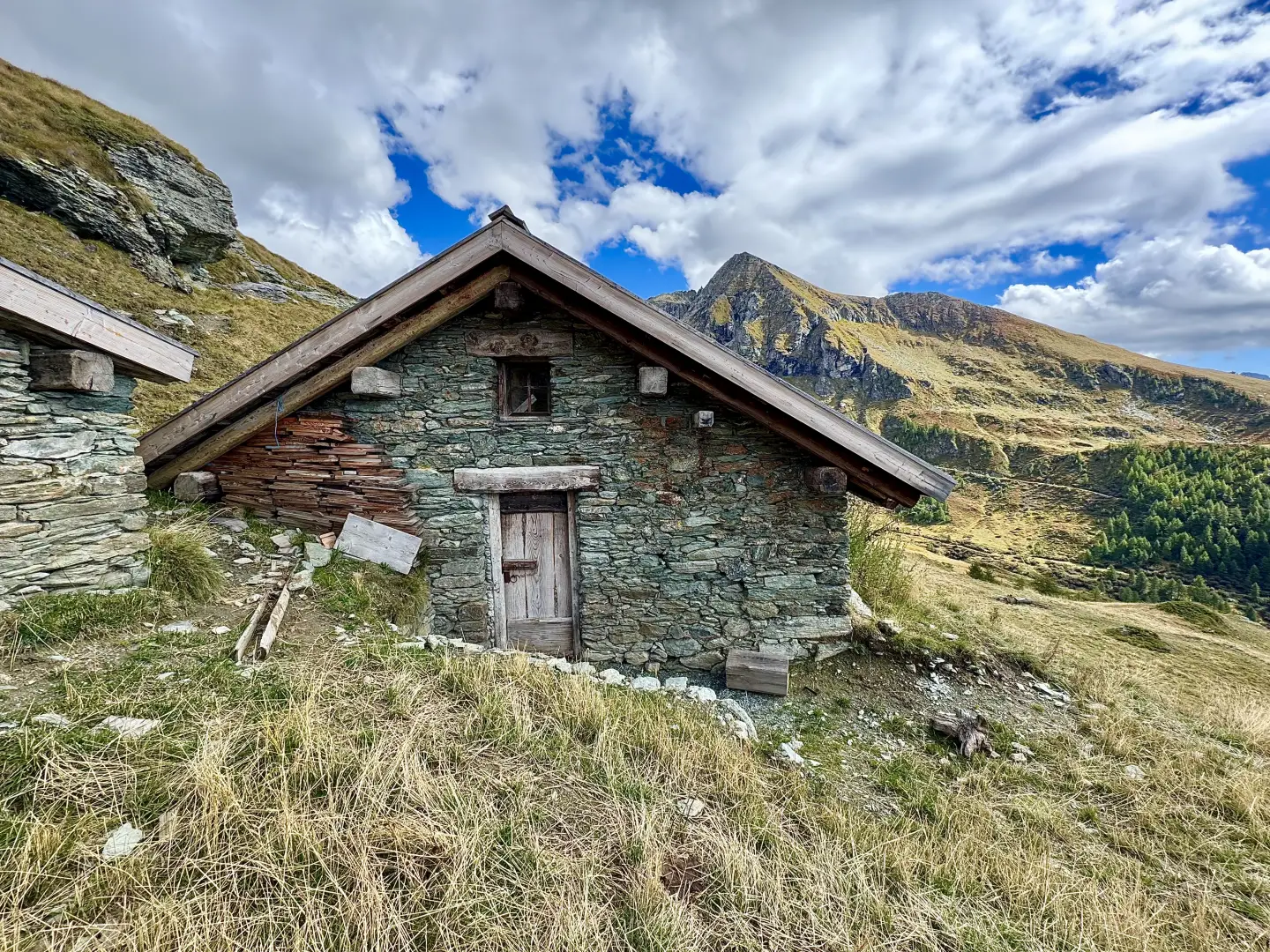
A linear route in the Val d’Ayas which, starting from the Estoul basin above Brusson, leads to the Merendioux mountain pasture, overlooking the Palasinaz valley. The first section climbs along farm tracks and mule tracks through larch woodland and pastures criss-crossed by ski lifts, passing the mountain pastures of Chanlochère and Chavanne; the second part leaves the track, descends to the bottom of a side valley and climbs up a path on the opposite slope to the mountain pasture.
From the mountain pastures of Chanlochère and Chavanne, the view opens out over the lower Val d’Ayas and the Glacier-Mont Avic massif; from Merendioux, the view extends to the Palasinaz basin. The mountain pasture features in the film *Le otto montagne*, where it is referred to as Barma.
The route presents no technical difficulties and follows unpaved roads, mule tracks and footpaths throughout. The central section involves a short descent, which must be climbed again on both the outward and return journeys.
Description
0h00' 0.00km From the signposts indicating the main trails in the area, take a farm track which, after about 50 metres, comes to a fork.
0h01' 0.05km Continue straight on, ignoring the signs for theMoucherolaz mountain pasture (1925m), and carry on along the flat, passing the isolated house at Prapitou (1886m) on your right, until you reach a junction. Keep to the right and begin the ascent towards the secondary summit of Mont Bieteron, leaving the pasture behind to enter the larch forest (Larix decidua). After a left-hand bend, you’ll reach a clearing with a drinking trough 💧 and another junction. Continue straight on, following the signs for the Arp Refuge along the path. A little further on, near Fontaine (1,903 m), leave the farm track and take a path on the right that crosses the larch forest and leads to the right-hand edge of the ski run. The path becomes a mule track, whilst the gradient increases slightly, and you soon reach a fork.
0h20' 0.85km (77 m elevation gain) Keep to the left and continue up the slope along the mule track to the right of the ski run, until you rejoin the dirt track, where you’ll find another signpost pointing towards the mountain hut.
0h30' 1.10km Turn left and follow the road, which soon passes above the houses of Chanlochère (2012m), offering interesting views over the lower Val d’Ayas and the peaks of the Glacier-Mont Avic range. The road winds through a series of hairpin bends and leads up the grassy slope crossed by the ski lifts and, a little further on, by the buildings at Chavanne (2,107 m). After a short flat stretch, the road begins to climb again until it reaches a hairpin bend, where there is a signpost (2,107 m).
0h00' 0.00km From the signposts marking the main trails in the area, take a farm track which, after about 50m, comes to a fork.
0h01' 0.05km Continue straight on, ignoring the signs for theMoucherolaz mountain pasture (1,925m), and carry on along the flat, passing the isolated house at Prapitou (1,886m) on your right, until you reach a junction. Keep to the right and begin the ascent below thesecondary summit of Mont Bieteron, leaving the pasture behind to enter the larch forest (Larix decidua). After a left-hand bend, you’ll reach a clearing with a drinking trough 💧 and another junction. Continue straight on, following the signs for the Arp Mountain Hut. A little further on, near Fontaine (1,903 m), leave the farm track and take a path on the right that crosses the larch forest and leads to the right-hand edge of the ski run. The path becomes a mule track and the gradient increases until you reach a fork.
0h18' 0.85km Keep to the left and continue up the slope along the track, to the right of the ski run, until you join the dirt track, where there is a signpost indicating the way to the mountain hut.
0h27' 1.10km Turn left and follow the road, which passes above the houses at Chanlochère (2,012m) with views over the lower Val d’Ayas and the Glacier-Mont Avic massif. After a few hairpin bends, the road leads up the grassy slope, crossed by the ski lifts, and reaches the Chavanne housing estate (2,107 m). After a short flat stretch, continue climbing until you reach a hairpin bend with a signpost.
0h48' 2.09km [to be completed] At the hairpin bend, leave the route towards the Arp Mountain Hut and continue westwards, on a gentle descent, to a second signpost.
0h51' 2.40km [to be completed] Turn north and descend along the slope, losing about 70 metres in altitude, to the bottom of the valley.
1h02' 3.11km [to be completed] Cross the valley floor and climb up the opposite slope, first heading north and then west. The path gains altitude heading north-west and, after a short downhill stretch, turns north-east for the final ascent to theMerendioux mountain pasture (2,263m), overlooking the Palasinaz basin 1h50' 4.81km .
The return journey follows the same route taken on the ascent, with the climb from the bottom of the valley up to the road above Chavanne 1h25' 9.60km (106 m elevation gain) (492 m elevation loss).
Comments (0)
Sign in to leave a comment