Fenêtre de Champorcher, from the Lillaz car park

Edited by:
Massimo Martini
Updated at: 06/06/2026
Access
Road navigation
Leave the motorway at the Aosta West junction and take the in the direction of Cogne. Drive through the village of Aymavilles and, after 1.5km, take the second exit at the roundabout remaining on the (1.5km). Continue along the regional road, passing the hamlets of Vieyes, Épinel and Crétaz, for a further 19.8km to the roundabout near Cogne. Take the first exit remaining on the (21.3km) and continue for 2.8km to the Lillaz car park (24.1km).
Parking
The 🅿️ car park in Lillaz is divided into three areas: the places closest to the start of the trails are paid for; the central ones are free; the area furthest away is reserved for motorhomes.
Access by public transport
The municipality of Cogne can be reached from Aosta with the SVAP 340 "Aosta-Cogne" line, operating all year round, departing from the Aosta Bus Station. In summer, the village of Lillaz can be reached from the Cogne Revettaz stop with the SVAP urban shuttle line 193 "Cogne Urbana Estiva", with a stop at Lillaz Piazzale. For up-to-date timetables of both lines please consult the SVAP Lines and Timetables page. Outside the summer period, a private vehicle is required to reach Lillaz from the Cogne stop.
Distance and travel time
🕒 Travel time: 33 minutes
📏 Distance: 24.1km
GPS navigation
Information note
The information provided has been verified as of the date of the survey of the itinerary. Before departure, it is recommended to check possible changes in the route or road conditions. Please consult Google Maps or Apple Maps for the latest information.
.Introduction
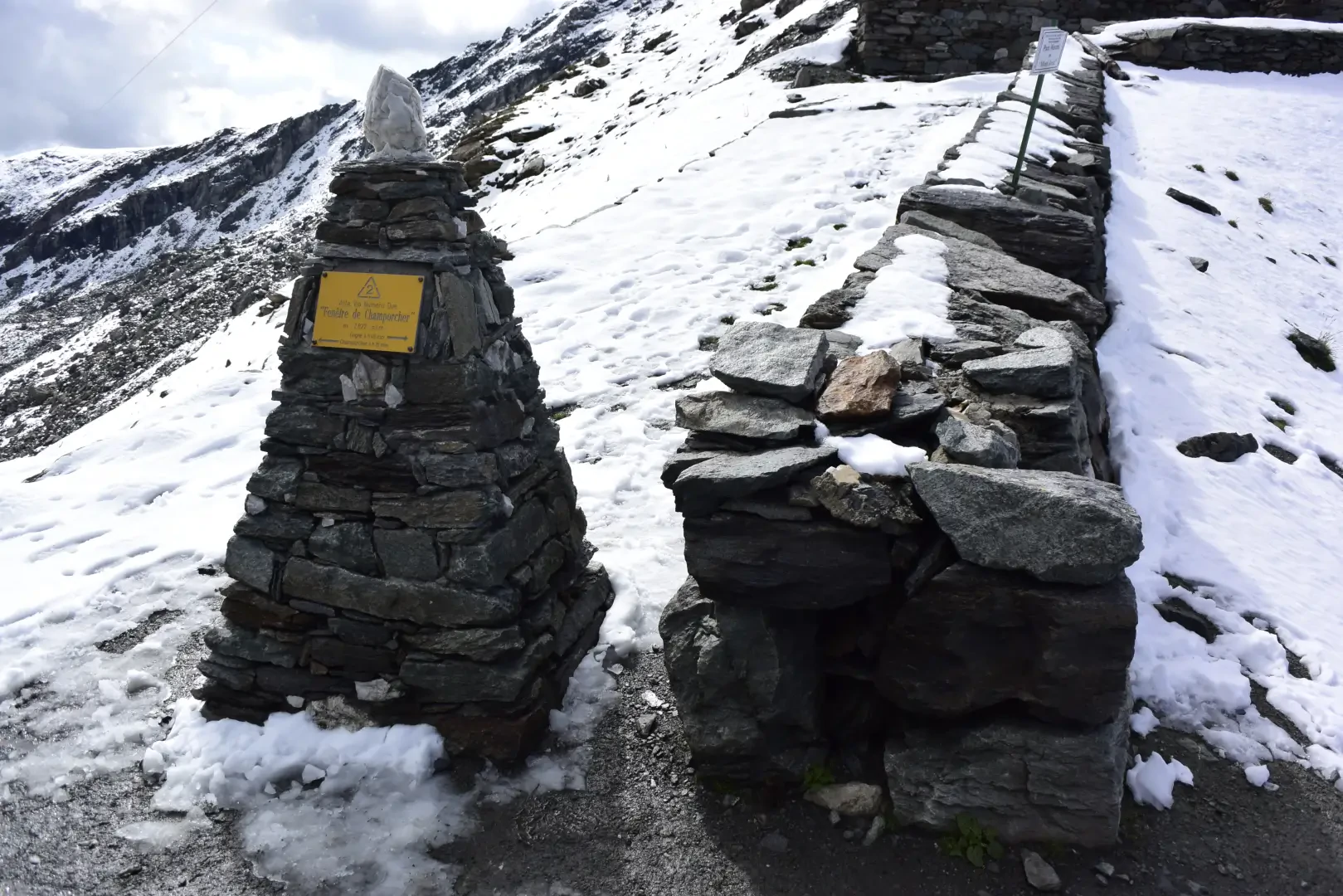
The route climbs the entire length of the Urtier valley, in the eastern sector of the Gran Paradiso National Park, from the hamlet of Lillaz to Fenêtre de Champorcher (2,830m), the pass separating the Val di Cogne from the Champorcher valley; the return is along the same route.
The ascent starts in the larch forest of the lower valley and gains height up to the pastures of Goilles Desot, before entering the area where the conifers thin out and the stone pine appears. In the upper part, the route runs halfway up the length of the valley, with Punta Tersiva at the head and the Grivola group in the background. It passes above the Broillot alpine pasture, reaches the Sogno di Berdzé hut at Peradzà and, from behind the hut, climbs steeply along the high-tension cables to the pass.
The recommended period is from June to September. July and the first half of August offer the best conditions for the high-altitude section, with residual snow generally absent; late September is the preferable window for those seeking isolation, with the pastures emptied and the attendance reduced. The overall height difference requires good training: the difficulty is maintained on a T2 scale for the entire duration, with the refuge-Fenêtre segment being the most physically demanding.
Description
0h00' 0.00km Leave the car and walk to the shelter where the main directions in the area are indicated; follow route in the direction of the Sogno di Berdzé refuge at Peradzà. Take the small road that runs alongside the Urthier stream and, after a few minutes, reach the traffic ban. At the fork, take the small road to the left and, shortly afterwards, meet the sign indicating the start of the path. Climb up through the larch forest in a series of hairpin bends to the fork for the Lillaz waterfalls .
[0h15T2] 0.55km Disregard the path for the Lillaz waterfalls and continue along the little road. Turn left and then immediately right, following the signs for the climbing hall; ignore the turnoff to the climbing hall on the right and proceed in an open section towards the rocky buttress. Turn right, cross the penstocks of the Lillaz CVA power station and reach the votive shrine located above the falls (1,726m). Descend slightly to reach below the pastures, cross them on the ascent and reach Goilles Desot (1,834m).
0h45' 1.77km Take the little agricultural road that leads to the bridge over the Urthier stream. Go to the orographic left and climb into the wood; at the clearing a little further on, ignore the agricultural track on the left and continue into the wood along the mule track that climbs the ridge. The stone pine (Pinus cembra) begins to appear in the wood. Cross a stream on a wooden footbridge, head towards the gorge of the Urthier stream and go round it to the fork for the Bardoney gorge (2,129m).
1h50' 4.67km Neglect the path for the Bardoney gorge and cross the stream on a small wooden bridge. Climb up to contour the headland, meeting the Teppe Longues park ranger's hut (2,156m). Punta Tersiva rises at the bottom of the valley, while the Grivola group stands out behind it. Proceed halfway up the hillside with slight ups and downs among the last conifers and alpine vegetation, along the entire length of the upper Urtier valley, passing above the Broillot alpine pasture. Cross two streams on two small wooden bridges, move towards the centre of the valley and reach the track. Follow it for about ten minutes until reaching the Sogno di Berdzé hut at Peradzà.
3h30' 10.24km From behind the hut, take the path that climbs steeply following the high-tension cables to the Fenêtre de Champorcher (2.830m) 4h30' 12.64km .
Return via the same route followed during the ascent 3h00' 12.64km .