Col de Nannaz, from the car parks at Frachey

Edited by:
Massimo Martini
Updated at: 16/07/2026
Access
At the Verrès motorway junction [A5], enter the roundabout and take the second exit towards the historic centre, following the . After 300m (0.3km), turn left, staying on the ; after a further 3.5km (3.8km in total), turn left again to join the towards Val d’Ayas. Follow the regional road for 23.5 km (27.3 km in total), passing through the villages of Challand-Saint-Victor, Challand-Saint-Anselme, Brusson, Vollon, Extrapieraz, Periasc and Champoluc. At the roundabout, take the first exit and continue on the for approximately 2.7 km (approx. 30 km in total). The Frachey car park is located on the left-hand side of the road, next to the valley station of the Monterosa Ski rack railway.
Car park
The Frachey car park 🅿️ is free of charge and marks the starting point of the route. From here, a shuttle service connects the car park to the small square in Saint-Jacques, where the route begins. For those arriving before 7.00 am, possible to drive on for about 500m and park for free 🅿️ on the left-hand side of the road, near the start of the route: in this case, add about 500m to the walk.
Access by public transport
The starting point can be reached via the Vita S.p.A. Verrès – Val d’Ayas service, which runs from 11 June to 9 September. The terminus for the uphill journey is Saint-Jacques, with an intermediate stop at Frachey. The most convenient morning departure for the hike leaves Verrès FS at 7.20 am (arriving at Frachey at 8.17 am and Saint-Jacques at 8.20 am); on weekdays, the 5.40 am service is also available (arriving at Frachey at 6.37 am and Saint-Jacques at 6.40 am). The return journey to Verrès is possible from either Frachey or Saint-Jacques: daily downhill services depart from Saint-Jacques at 12:25, 15:25, 18:25 and 20:30. For full timetables, please consult the official table at the link provided.
Distance and journey time
🕒 Journey time: approximately 44 minutes
📏 Distance: approximately 30.1 km
GPS navigation
Important information
The directions provided were verified on the date the route was mapped. Before setting off, we recommend checking for any changes to the route or road conditions. For up-to-date information, please consult Google Maps or Apple Maps.
Introduction
A route that climbs up the Vallone di Nannaz in the upper Val d’Ayas, in the municipality of Ayas, reaching the Col de Nannaz (2,774 m): a pass on the ridge separating the Val d’Ayas from the Valtournenche and a transit point on the Alta Via 1 VdA between the two valleys.
The route passes through a succession of mountain pastures in the valley — Alpe Croues, Nannaz dessous, Tournalin dessous — ascending through woodland and pastureland to the Grand Tournalin mountain hut, an intermediate stop just under two-thirds of the way along the route. Beyond the refuge, the route climbs the south-eastern slope of the Petit Tournalin over sparse pasture and scree, up to a plateau which seasonally hosts a small pool of water just before the pass.
The route is suitable for hikers in good physical condition, as the total elevation gain exceeds a thousand metres. In the final stretch between the refuge and the pass, there is a short rocky step, which can be negotiated without using your hands. About one hundred metres before the pass, a boulder with a trail marker indicates the fork for the Petit Tournalin: continue straight on to reach the pass. The route is accessible from June to the end of September, when it is free of residual snow.
Description
0h00' 0.00km From the car parks, follow the regional road uphill alongside the Évançon stream until you reach the small square at Saint-Jacques. Continue for a short distance to the chapel, beyond which there is a junction with a signpost. Ignore the path towards Resy and, shortly afterwards, you will reach another signpost.
0h05' 0.00km Take the mule track which soon leads to the small hamlet of Pelioz (1,722m) and continue to the left along a flat stretch. Enter the woodland and reach the pastures below the Droles chalets (1,760m); go round them and re-enter the fir forest. Climb until you first come to a small wayside shrine and then to Alpe Croues (1,872m).
0h25' 0.98km Return to the woodland and quickly gain altitude, heading towards the Torrent de Nannaz; follow the left bank of the stream until you join a small farm track. Follow this for a few tens of metres and rejoin the path. Climb a short stretch through the woods and emerge onto the pastures below Nannaz desot (2,049m).
0h50' 1.78 km (365 m ascent) (7 m descent) Climb up to the track just above the mountain pasture and continue to the left until you reach a farmhouse. Following the markings on the ground, take the path leading to a plateau. Walk alongside the stream, keeping to the right-hand side (as you face the stream), and cross the plateau with the Bec de Nannaz in view. At the end of the plateau, you’ll reach a small wooden bridge; cross the stream and climb up the grassy ridge to the Tournalin desot mountain pasture (2,279m).
[1h40’T2] 3.77 km (606 m ascent) (18 m descent) Follow a short stretch of farm track and rejoin the path, climbing up through the pastures leading to the refuge. Enter the final part of the cirque at the foot of the Petit Tournalin and the Grand Tournalin, turn right and reach the Grand Tournalin mountain hut (2,534m).
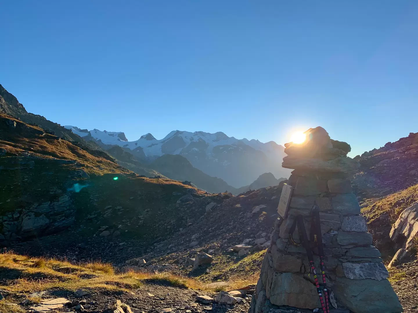
[2h20’T2] 4.94 km From the Grand Tournalin mountain hut, descend briefly along the dirt track and, at the fork, take the path on the right. Climb up the south-eastern slope of the Petit Tournalin through sparse pasture and scree, following a contour path halfway up the slope which allows you to gain altitude gradually. Reach a rocky step; cross it without needing to use your hands, and make your way onto the plateau leading up to the pass, which has a moderate gradient. As you approach the Bec de Nannaz, you’ll reach a boulder with trail markers, where the path to the Petit Tournalin branches off to the right. Continue straight on, keeping to the left of a small depression seasonally occupied by a small lake, and reach the Col de Nannaz (2,774m). [3h00’T2] 6.43km (1,153mD+) .
The return journey follows the same route as the ascent. [1h45’T2] 6.43km (1,153mD-).
Places of Interest
Saint-Jacques
Grand Tournalin Mountain Hut
Col de Nannaz
Comments (0)
Sign in to leave a comment